Moran Constitutional Relay Preview
Posted by Adam Stuhlfaut, Director of Running on
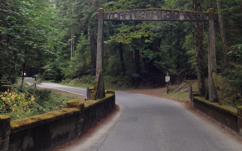
Northwest Trail Runs just announced a brand new trail relay raced called the Moran Constitutional Relay, scheduled for October 22 and 23 on Orcas Island. Named after Moran State Park and its signature landmass Mt. Constitution, the race consists of 12 legs and 70 miles of trail running. Like a Ragnar relay race, each team will have to drive from point to point to switch runners for each leg. Unlike Ragnar, the Moran event will have scheduled “off” hours so that participants don’t have to ruin their sleep for the race. I was looking to run just this type of event and was excited when it was announced. Last weekend, I traveled to Orcas Island to check out some of the trails to get a sense of the landscape prior to gathering a team together for the race.
Day 1: Cascade Lake Loop - 2.9 miles
It takes about 3 hours to get from the Seattle area to Moran State Park: an hour and a half drive to the ferry terminal at Anacortes, an hour on the ferry, and a twenty minute drive to the park entrance. When I arrived in the afternoon I wanted to do a short run to shake out the legs. I camped near Cascade Lake and chose to do a loop of that lake. That trail is a relatively easy 2.9 mile loop of mainly flat running, with a few brief ups and downs (10 foot rises and drops). The only real climb is the only section of the trail that is across the road from the lake. The trail climbs from around 300 feet to about 500 feet to go up a hill around the backside of the camp. Halfway around the lake there’s an option to add about a mile loop around a lagoon, plus a 15-foot high bridge that is used for jumping into the channel between the lake and the lagoon.
Day 2: Mt. Constitution Summit from the Cascade Lake Trailhead – 3.9 miles + 2100 ft of elevation gain
Moran State Park has a number of trail routes that approach the summit of Mt. Constitution, plus a car road to the top if you want the views without the hard work. Mt. Constitution, at 2400 feet altitude, is the largest mountain in the San Juan Islands. While quite a bit smaller than its compatriots in the Cascades or Olympics, Mt. Constitution can pack a punch on challenging trails. That challenge comes from the fact that most of the elevation gain comes in the bottom section of the trails when your body is not quite warmed up (although it will be soon). The Cascade Lake trail to the summit rises up almost 2000 feet of elevation gain in the first two miles. The trail through that first steep section follows a stream bed via many switchbacks. The deep forest is beautiful and is a good distraction from the work at hand.
The second half of the trail eases up as it passes through the marshy Cold Spring area which feels like a dinosaur era forest of big trees and ferns. It is also noticeably cooler in this section, and the cool air combined with the flatter terrain makes for a great way to recover from the climb in the first section.
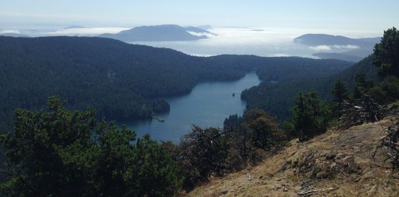
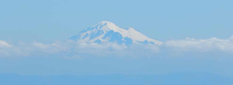
After you cross to the east side of the summit car road, at about the 3 mile mark you can either take a left and head directly to the summit or take a right and head to the Little Summit lookout. I took a left and the trail quickly exits the deeper forest for a more exposed ridgeline for about a ½ a mile. That ridgeline trail had some massive views to the south and east as it wraps around toward the summit area. Once I got to the summit viewing area I was greeted with an amazing view of the top half of Mt. Baker above some clouds. At the summit there is a food truck that sells Lopez Island Ice Cream and I rewarded myself with an ice cream sandwich, a reward that doesn’t happen too often on summit runs.
Day 3: Mountain Lake from Cascade Lake via Cascade Falls - 8.1 miles
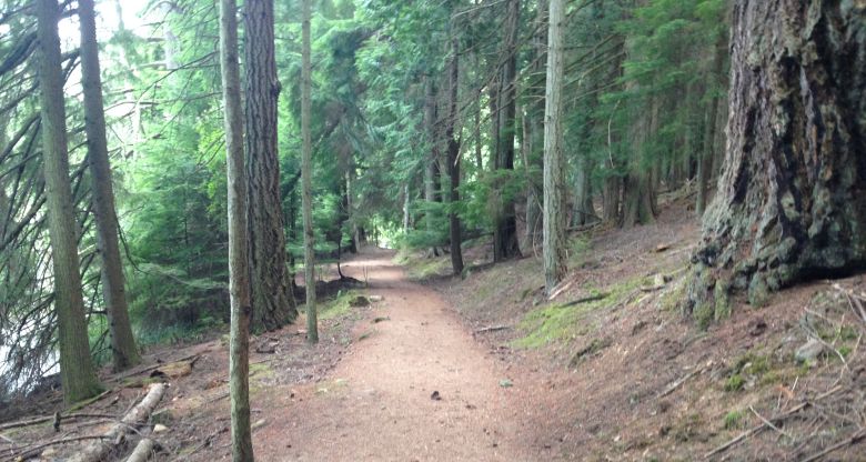
The final day, I opted for less elevation gain and went to loop to the larger lake in the park, Mountain Lake. I took the trail out of the Cascade Lake camping area and passed through the Cascade Falls area that has a series of four small but beautiful waterfalls that are fed from the dam at the south end of Mountain Lake. This first two-mile section, from the campground to Mountain Lake, does have about 800 feet of climb, while not as challenging as the day before, it was steep nonetheless. Once you get to Mountain Lake, the trail is much like well-maintained Cascade Lake, just a mile longer (3.9 miles versus 2.9 miles). Some of trail is single track, but most is about 3-4 feet wide. The water is noticeably green and the lake has many small islands just begging to be explored via canoe or kayak.
I had three amazing runs on a really well-maintained and signed trail system. Plus, Orcas Island has no large predators to worry about (i.e. no bears or mountain lions). The only large wildlife is the population of deer. Due to inbreeding issues (as explained by a volunteer learning center staff member), they are spotted and, at times, fully white.
I’m excited for the relay. Moran State Park has many more trails I didn’t a change to see, but I hope to see during the Moran Constitutional Relay.